


Drones in Agriculture: How Can They Be Used with SWAT MAPS?
Wednesday, January 26, 2022 12:00 PM
Reading Time: 4 minutes
Drones have received a lot of attention in agriculture, especially since they became affordable mapping tools about eight years ago. Back then, they were projected to transform agriculture. Although hardware, software, and camera technology have improved, many of the challenges faced by drones in 2014 are still evident today. Scalability remains a major hurdle. Widespread beyond visual line of sight (BVLOS) & fully autonomous operations have not yet become common, and human operated flight and processing is still prominent in drone applications in agriculture today.
In the early days, much of the focus was placed on using drones to capture imagery for generating normalized difference vegetation index (NDVI) and crop health maps. While drones can do this, satellite imagery has improved in terms of frequency and spatial resolution and is a more practical option. A general crop health / biomass / NDVI image can easily be obtained through many ag data management systems for free. Frequency and clouds can still pose issues, but as more earth imaging satellites enter orbit, this issue will soon be resolved. In the case of NDVI and what it is used for, usually it is to gain an understanding of the status of the crop at a certain point in time. Which areas of the field are doing well? Which areas are having issues? Is that green area on the NDVI image just a patch of weeds? Is the red area simply a result of equipment issues?
The image will not tell you what the problem is - it still requires ground truthing.
In some cases, NDVI and other vegetation indices are used to influence in season fertilizer, herbicide, or fungicide prescriptions. For this, though, high resolution drone imagery is not necessary since most equipment cannot yet apply product at that resolution anyway. In most cases, 10m satellite imagery works fine if it is available.
So, which applications make the most sense for drones in agriculture?
Monitoring Agronomic Research Trials:
Trials involving multiple fertilizer treatments, seed spacing, soil amendments, tillage methods and more, have traditionally involved manual, subjective, and laborious means of assessment. Since large field trials can be difficult to manage due to labor issues, small plots are common to compare various treatments. Farmers often dismiss small plot trials as they do not provide a realistic representation of commercial scale agriculture. Small plot trials also make it difficult to compare treatments throughout different soil-based management zones (i.e. SWAT Zones) or microenvironments. It is also difficult to get accurate yield maps from harvesting equipment. Drones can cover larger areas than just small plot research farms and provide detailed information about many characteristics such as chlorophyll content, plant population, plant height, plant size, spacing and more.

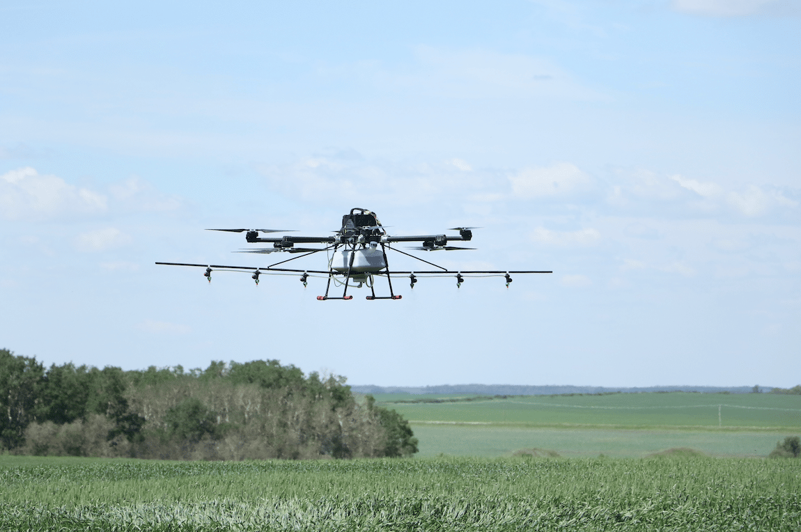
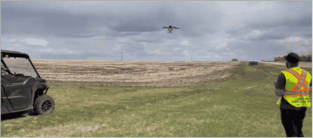
Spot spraying / spot application/ seeding:
Drones have increasingly been used to apply products such as pesticide, herbicides, micronutrients, and seed. Think of a large field where only 5-10% of the field area is too wet (i.e. SWAT Zone 10 depression areas) to drive across with a piece of machinery. A single drone can seed over 20 ac in an hour and is perfectly suited to apply seed in wet spots that are scattered across a field. Likewise, if a micronutrient only needs to be applied to certain areas of a field, such as hilltops, a drone can be a useful applicator compared to larger equipment. As battery technology and payload capacity improve, drone-based applicators will have more uptake. Eventually, it may be common to see drone applied products across a whole field.
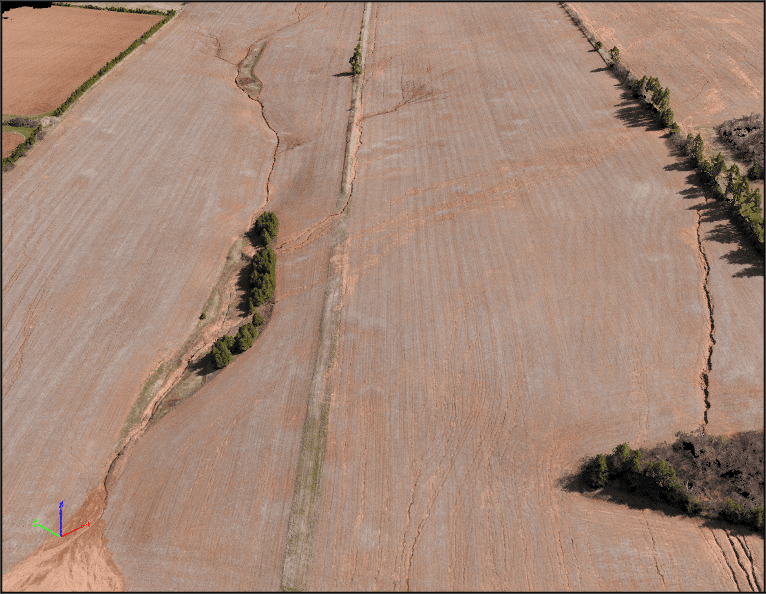
Soil Conservation
Properly timed drone surveys of a bare soil field can reveal erosion issues and assist soil and water engineers in developing plans to address the problem. The high-resolution imagery provided by the drone easily identifies sheet, rill, and gully erosion. The imagery can also be used to develop accurate digital surface models, and help engineers properly place soil conservation structures, such as grassed waterways and berms to manage surface water flow. SWAT models can be applied to drone-based elevation data assuming it was captured in a field with bare soil or consistent and low residue levels. If topsoil restoration is something the farmer is interested in, a SWAT MAP is a great place to start to understand where soil should be taken from and where it should be placed. Thermal imagery from drones can reveal areas of the field with low moisture holding capacity, providing an indication of deposition of topsoil from further up the hill.
Scouting… Maybe not?
Drones have been, and still are, used for crop scouting. But they have not replaced traditional crop scouts on a large scale. That is not to say that traditional crop scouting will not be replaced by technology at some point. It is more likely that tractor mounted imaging systems such as SWAT CAM, real time see and spray systems, and robotics will disrupt traditional scouting methods. They remove a step in the process: requiring someone to actually fly a drone. Tractor or vehicle mounted systems work without any human interaction. Drones may provide more flexibility in terms of timing of imagery for scouting, and fully autonomous operations would provide a big boost in the uptake of drones as scouting tools.
After years of being overhyped and overpromised, drones are finally finding their niche in agriculture and will have a place in the industry for years to come. They do not need to be viewed as a competitor to satellite imagery or soil-based mapping solutions like SWAT MAPS. They can be used in combination with these technologies to advance agronomic decision making and help farmers grow better crops.
Become a SWAT News insider!
Sign Me Up!
Join Our Mailing List
Enter your email below to sign up for our mailing list.
We care about the protection of your data. We’ll never share your details.
Croptimistic Technology Inc. is an international agriculture technology (AgTech) company. We began operating in 2018. Croptimistic is supported by a growing team of professionals who have dedicated their careers to developing the best soil mapping software and hardware in the world.
Copyright Croptimistic Technology Inc. © 2024 All Rights Reserved.
Privacy Policy